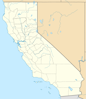
Crescent City, California
| City of Crescent City | |
|---|---|
| — City — | |
 |
|
 City of Crescent City
|
|
| Coordinates: | |
| Country | United States |
| State | California |
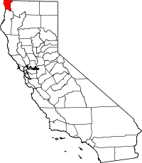
| County | Del Norte |
| Government | |
| - Mayor | Kelly Schellong |
| - Senate | Sam Aanestad (R) |
| - Assembly | Patty Berg (D) |
| - U.S. Congress | Mike Thompson (D) |
| Area | |
| - Total | 2.1 sq mi (5.3 km2) |
| - Land | 1.8 sq mi (4.6 km2) |
| - Water | 0.3 sq mi (0.7 km2) |
| Elevation | 43 ft (13 m) |
| Population (2002) | |
| - Total | 7,300 |
| - Density | 1,907.6/sq mi (755.8/km2) |
| Time zone | Pacific (PST) (UTC-8) |
| - Summer (DST) | PDT (UTC-7) |
| ZIP codes | 95531, 95532, 95538 |
| Area code(s) | 707 |
| FIPS code | 06-17022 |
| GNIS feature ID | 0277494 |
| Website | www.crescentcity.org |
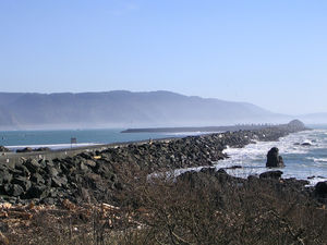
Crescent City is the county seat and only incorporated city in Del Norte County, California. Named for the crescent-shaped stretch of sandy beach south of the city, the city had a total population of 4,006 in the 2000 census with an estimated population of 7,300 (2002), which includes inmates at Pelican Bay State Prison, also within the city limits. Crescent City is the site of the Redwood National Park headquarters.
Contents |
Geography
According to the United States Census Bureau, the city has a total area of 2.1 square miles (5.3 km²), of which 1.8 square miles (4.6 km²) is land and 0.3 square miles (0.7 km²) is water. The total area is 13.59% water.
Crescent City is about 20 miles from the border of California and Oregon.
The mouth of Elk Creek, where it flows into the Pacific Ocean, is in Crescent City.
Climate
Crescent City is one of the wettest places in California; the annual rainfall is 70 in (1,800 mm). The wettest months are from October to March; the wettest month is January with 13.3 inches (340 mm) and driest month is August with less than 0.5 in (13 mm). The average high and low temperatures in January are 53 °F (12 °C) and 39 °F (4 °C). The average high and low temperatures in August are 67 °F (19 °C) and 50 °F (10 °C). Average number of days below 32°F/0°C is 15 days.[1]
The highest temperature recorded in Crescent City was 93 °F (34 °C), observed on September 24, 1964, June 1, 1970, and October 10, 1991. The lowest temperature on record was 19 °F (−7 °C) on December 21, 1990.
The maximum monthly precipitation was 31.25 inches (794 mm) in November 1973. The maximum 24-hour precipitation was 7.73 inches (196 mm) on January 9, 1995. The most snowfall in one month and in 24 hours was 6.0 inches (15 cm) on January 6, 1972.[2]
| Climate data for Crescent City, CA | |||||||||||||
|---|---|---|---|---|---|---|---|---|---|---|---|---|---|
| Month | Jan | Feb | Mar | Apr | May | Jun | Jul | Aug | Sep | Oct | Nov | Dec | Year |
| Source: The Weather Channel[3] | |||||||||||||
Tsunamis

Crescent City is susceptible to tsunamis. According to Humboldt State University,[4] the city experienced tsunami conditions 17 times between the years 1943 and 1994. Although most of these effects were barely perceptible, one tsunami in particular extensively damaged the city in 1964.
On March 27, 1964, the Good Friday Earthquake off Anchorage, Alaska, set in motion local landslide tsunamis, as well as a trans-Pacific one that sped in three hours down the U.S. West Coast to the state of Washington. Destroying docks, boats, cars, coastal dwellings and surging up rivers with the same result, the tsunami continued down the coast.
Within another 1½ hours, four waves struck over a two-hour period at Crescent City. When they had finished, 289 buildings and businesses had been destroyed; 1000 cars and 25 large fishing vessels crushed; 12 people were confirmed dead, over 100 were injured, and numbers were missing; 60 blocks had been inundated with 30 city blocks destroyed in total. Although most of the missing were later accounted for, not all were tracked down. Insurance adjusters estimated that the city received more damage from the tsunami on a block-by-block basis than did Anchorage from the initial earthquake.[5]
The tsunami raced down the U.S. West Coast with more deaths and destruction, but no location was hit as hard as this small town was. Crescent City bore the brunt, due to its offshore geology, position relative to the earthquake’s strike-line, underwater contours such as the Cobb Seamount, and the position of rivers near the city. Although houses, buildings, and infrastructure were later rebuilt, years passed before the city recovered from the devastation to lives, property, and its economy.
The city is deemed to be tsunami-ready today. Its preparedness was tested on June 14, 2005 when an earthquake measuring 7.0 on the Richter scale hit 90 miles (140 km) offshore. Reportedly, much of the city was evacuated in a matter of 20 minutes when a tsunami warning was issued, but no waves were reported.
On November 15, 2006, a magnitude 8.3 earthquake struck off Atisov Island in the Kuril Islands in the western Pacific. A tsunami warning was issued but rescinded hours later. However, a surge from that quake did hit the harbor at Crescent City causing damage to three docks and several boats. Governor Arnold Schwarzenegger declared a county state of emergency. Upon that declaration, the area affected was eligible for federal emergency relief funding to repair the damage.[6]
Politics
In the state legislature Crescent City is located in the 4th Senate District, represented by Republican Sam Aanestad, and in the 1st Assembly District, represented by Democrat Wes Chesbro. Federally, Crescent City is located in California's 1st congressional district, which has a Cook PVI of D +10[7] and is represented by Democrat Mike Thompson.
Demographics
As of the 2003 Population Estimate from the Census Bureau, there are 7,319 people residing in the city. Census data from the year 2000 indicate that the population density is 2,252.2 people per square mile (868.9/km²). There are 1,754 housing units at an average density of 986.1/sq mi (380.5/km²). The racial makeup of the city is 78.33% White, 0.52% Black or African American, 6.09% Native American, 4.62% Asian, 0.12% Pacific Islander, 4.27% from other races, and 6.04% from two or more races. 11.01% of the population are Hispanic or Latino of any race.
There are 1,578 households out of which 35.6% have children under the age of 18 living with them, 33.4% are married couples living together, 20.5% have a female householder with no husband present, and 41.7% are non-families. 35.8% of all households are made up of individuals and 13.6% have someone living alone who is 65 years of age or older. The average household size is 2.40 and the average family size is 3.12.
In the city the population is spread out with 30.1% under the age of 18, 11.1% from 18 to 24, 26.7% from 25 to 44, 18.2% from 45 to 64, and 13.9% who are 65 years of age or older. The median age is 32 years. For every 100 females there are 85.9 males. For every 100 females age 18 and over, there are 82.4 males.
The median income for a household in the city is $20,133, and the median income for a family is $22,058. Males have a median income of $36,667 versus $19,922 for females. The per capita income for the city is $12,833. 34.6% of the population and 33.7% of families are below the poverty line. Out of the total population, 46.6% of those under the age of 18 and 4.8% of those 65 and older are living below the poverty line.
Transportation
Highway access is provided by U.S. Route 101 that runs directly through the city. U.S. Route 199 begins just north of Crescent City and connects northeast to Grants Pass, OR.
SkyWest Airlines conducts passenger flights to and from Jack McNamara Field Airport as United Express. The majority of flights connect to San Francisco International Airport. The airport also features one daily flight to Sacramento International Airport through Arcata-Eureka Airport.
Local public transit is provided by Redwood Coast Transit and by various Taxi companies, which provides access to Amtrak passenger train (via Amtrak bus) service.
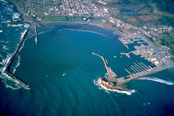
The Crescent City Harbor serves as a commercial fishing boat basin for salmon, shrimp, tuna, cod, and dungeness crab commercial fishing vessels. The Harbor is also home to multiple fishing and non-fishing related businesses and harbor governmental offices. The Crescent City Harbor also has several pleasure boat docks.
Historic ships
Crescent City was the name of a 113 ton schooner built in 1848 by Joshua T. Foster of Medford, MA.[8] A 1906 ship named Crescent City was the former Jim Butler, a 701 ton steam schooner built by Lindstrom Shipbuilding Company in Aberdeen, WA. She was wrecked in the Channel Islands, off Santa Cruz Island, in 1927.[9]
Attractions and facilities
Crescent City proper
- Battery Point Lighthouse
- Del Norte County Historical Society Main Museum
- Ocean World
- Beachfront Park
- Crescent City Harbor
- Wreckage of the SS Emidio, the first American vessel sunk by the Japanese along California's coast during World War II
Crescent City also boasts one of the few fireworks displays for the Fourth of July holiday in the immediate geographic location.
Shopping
Crescent City offers many different shopping venues.
- Grocery Stores: Safeway, Grocery Outlet, Shop Smart, Ray's Food Place
- Variety/ Department: Dollar Tree, Walmart, Payless Shoe Source
- Drug: Walgreens, Rite Aid,
- Hardware: Ace Hardware, The Home Depot, Coast True Value
- Fast Food: McDonalds, Burger King, Taco Bell, KFC, Jack in the Box, Starbucks, Dutch Bros., Subway, (two locations), Pizza Hut
- Movies: Crescent City Cinemas, Spotlight Video
- Banks: U.S. Bank, Bank of America, Tri Counties Bank, Coast Central Credit Union, Chetco Federal Credit Union, Chase Bank, North Valley Bank
- Hotels: Hampton Inn and Suites, Quality Inn, Best Western: Northwoods Inn, Anchor Beach Inn, Lighthouse Inn, Curly Redwood Lodge, Super 8 Motel, Econo Lodge, America's Best Value Inn, Town House Motel, and Front Street Inn.
- Crescent City also features many small, local shops located in the Downtown Business District.
Nearby
- St. George Reef Lighthouse
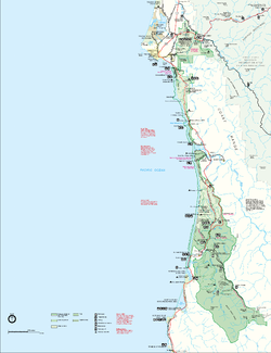
- Redwood National and State Parks
- Del Norte Coast Redwoods State Park
- Jedediah Smith Redwoods State Park
- Smith River National Recreation Area
- Trees of Mystery
- Pelican Bay State Prison
- Elk Valley Casino
- Del Norte Golf Course
- Lost Monarch (tree) - Largest Known Coastal Redwood by volume.
Notable residents
- Buck Pierce, professional football player for BC Lions (Canadian Football League).
- Derrick Jensen, environmentalist activist and author.
- Robert Swanson, first and longest serving Hospital Administrator for Seaside Hospital (1955–1986). Along with Richard Cooper (BSN MS), Director of Nursing, established the first Hospital Intensive Care Unit in the county in 1980.
Schools
Private schools
- Crescent City Junior Academy is a K-10 school operated by the Crescent City Seventh-Day Adventist Church (website). It was formerly known simply as the Seventh-Day Adventist School.
- Foursquare Christian School is a PK-8 ministry of the Crescent City Foursquare Church.
- St. Joseph's School, operated by St. Joseph Roman Catholic Church of the diocese of Santa Rosa, has been a feature of Crescent City for decades, supplying Catholic education to generations of K-8 students.
Public schools
The public schools of Crescent City are part of the Del Norte County Unified School District (website), which encompasses all of the public schools in Del Norte County. The following are schools within Crescent City or its immediate environs.
- Del Norte High School is the only public high school in Crescent City, located on the northern edge of town. It replaced the earlier high school that was more centrally located, and which remains today as a public-access gymnasium and county offices. (website)
- Bess Maxwell Elementary School is the older of two elementary schools in the northern part of town that are located near the high school. Bess Maxwell serves grades 1-5. In its earlier years, it was a K-6 school.
- Castle Rock Charter School is a K-12 charter school that provides personalized education to students, and is the liaison school for parents who home school their children. Among other programs, it operates the Tah-Ah-Dun American Indian Magnet School to provide for the unique requirements of American Indian students that might be at risk of dropping out of school. (Tah-Ah-Dun is the Tolowa name for Crescent City, honoring the Tolowa village that once stood where Crescent City is today.) The school is accredited by the Western Association of Schools and Colleges.
- Crescent Elk Middle School is the oldest operating school site in town, centrally located in Crescent City. The site was originally a K-8 school, but slowly shed grade levels to other schools as it became a 4-6 school with a separate 7-8 program, then the 6-8 program that it is today.
- Mary Peacock Elementary School is the newer of two elementary schools that are located near the high school. The creation of Pelican Bay State Prison caused an increase in housing demand in the Crescent City area, and an increased school district population. This school was built as a result of that demand, but is not directly associated with the prison.
- Joe Hamilton Elementary School is a K-5 school located near Crescent Elk Middle School. It was founded as a K-3 school.
- Pine Grove Elementary School has been a K-6 school for many years. It serves the eastern part of Crescent City.
- North Coast State College was a by mail/online college that started in 1993 and went out of business in 1999. The college specialized in law enforcement and correctional related fields. The owner was later investigated for mail fraud and other federal violations.
References and sources
References
- ↑ Weatherbase: Historical Weather for Crescent City, California, United States of America
- ↑ http://ggweather.com/climate/crescent_city.pdf
- ↑ "Monthly Averages for Crescent City, CA". Weather.com. 2010. http://www.weather.com/weather/wxclimatology/monthly/USCA0264. Retrieved 2010-04-17.
- ↑ Humboldt State page on tsunami events near Crescent City
- ↑ Powers, 2005
- ↑ Los Angeles Times article on the quake and tsunami
- ↑ "Will Gerrymandered Districts Stem the Wave of Voter Unrest?". Campaign Legal Center Blog. http://www.clcblog.org/blog_item-85.html. Retrieved 2007-10-19.
- ↑ Gleason, Hall (1937). Old Ships and Ship-Building Days of Medford. Medford, MA: J.C. Miller. p. 71.
- ↑ "Crescent City, CINMS Shipwreck Database". NOAA / National Marine Sanctuaries. http://channelislands.noaa.gov/shipwreck/dbase/mbnms/crescentcity.html. Retrieved May 23, 2010.
Sources
- The Raging Sea: The Powerful Account of the Worst Tsunami in U.S. History, Dennis Powers, (New York, New York: Kensington, 2005)
External links
- Local Information
- Official Crescent City website
- KHSR-FM 91.9 Crescent City-Brookings - Diverse Public Radio
- The Daily Triplicate newspaper.
- Crescent City Weekly
|
||||||||||||||||||||
|
|||||||||||